Zoning Maps
Zoning is local law that regulates various aspects of how land can be used. These regulations can include what type of land uses are allowed on a property, the intensity and density of development, limitations on the height, bulk and placement of structures, as well as other aspects of land use and development activity. The County of San Bernardino regulates zoning for all unincorporated areas of the county. The official document that regulates zoning for all unincorporated areas of the county is the County of San Bernardino Development Code. There are several options available to obtain zoning information for properties within the unincorporated areas of the County of San Bernardino, including an interactive zoning map.
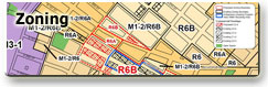
Interactive Online Zoning Map
A Two Map system was adopted with the Countywide Plan. View the Digital Zoning Map linked below:
General Plan Maps
The Countywide Policy Plan (adopted in 2020) includes a comprehensive set of maps that are maintained through the County’s interactive and dynamic web-based platform. This system allows users to search and filter map content across all plan components.
For the official and most up-to-date maps, including Land Use, Housing, Hazards, Transportation, and more, please visit the Countywide Plan Maps, Tables & Figures webpage within the adopted Countywide Plan.